

A Wet Weather Pattern Ahead
- WeatherSD

- Apr 24, 2024
- 1 min read
Updated: Apr 26, 2024
A nice day is in the cards today, with afternoon high temperatures in the 60s in the east and the 60s and 70s in the west.

Southern winds will be 5 to 15mph, with stronger winds in the northwest and west-central, 10 to 30mph, and gusts up to 40mph.

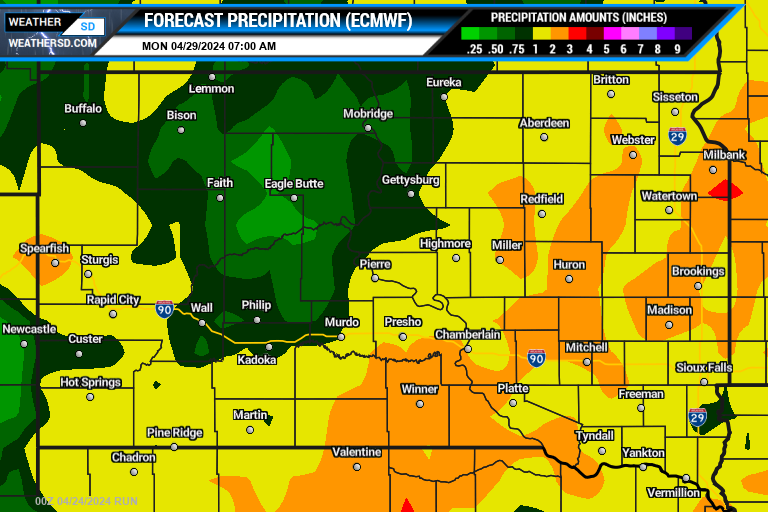
A wet weather pattern is ahead, with increasing clouds and the chance of precipitation starting tomorrow.


Rain from the end of the work week and into the weekend will bring widespread amounts of over half of an inch.

Parts of western South Dakota on Thursday and southeast South Dakota on Friday may experience strong to severe thunderstorms. A widespread severe weather event is not expected, but the first system could produce a couple of isolated strong storms. The best risk for these strongest storms will be in the far southeast part of the state on Friday.


