

Blizzard Conditions?
- WeatherSD

- Nov 10, 2021
- 1 min read
During the early morning hours, the National Weather Service in Aberdeen has placed a couple of counties in northeast, South Dakota under a Winter Storm Watch for Thursday evening through Friday afternoon.

Today, a cold front will push across the state and bring rain showers and much colder air to the region. The heaviest rainfall will be across the east.


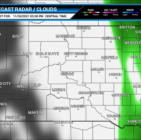


Then during the morning through the early afternoon of Veteran's Day (Thursday) conditions across the state look dry but windy.


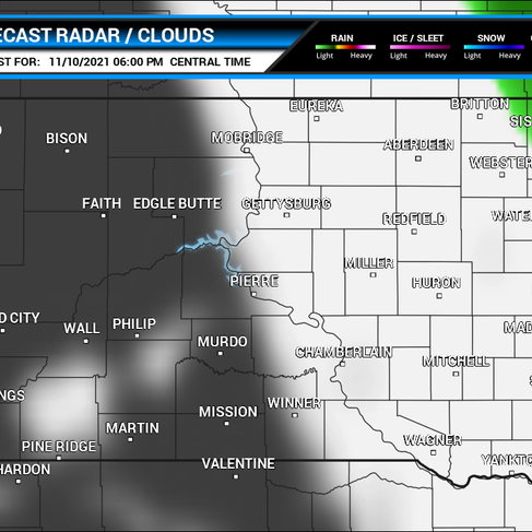
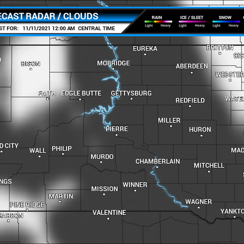
By Thursday afternoon, snow will start to filter into the region from the north. Snow chances will continued to spread across east as the wraparound precipitation pushes south.


Thursday evening and into Friday, snow chances continue with areas of blowing snow and reduce visibilities. At times, some wind gust of 50mph are possible.


Snow amounts look to the heaviest across the northeast where one to four inches are expected. Areas from Clark to Webster, Britton and Sisseton stand the highest risk for a couple of inches. Those in Brookings, Madison and DeSmet may see about an inch with isolated higher amounts up to two inches.
Central and western, South Dakota will sit out on this event as no snow accumulations are expected.

For details on your forecast, visit our Your Forecast page.
Source: NWS, GFS, NDFD


