

Blizzard Conditions Expected from Powerful Northwest Winds
- WeatherSD

- Jan 12, 2024
- 1 min read
A surge of brittly cold arctic air will plummet temperatures statewide starting today and continue through the weekend. Wind Chill Warnings are in effect for the weekend as readings are forecast to drop into the 30s, 40s, and even 50s below zero.

Snow chances will continue through the early afternoon across southeast, SD with additional accumulations from one to four inches. Light snow or flurries for the west as that bitterly cold air starts pushing into the region. Today's high temperatures will be a few degrees above zero in the east and a few degrees below zero in the west.
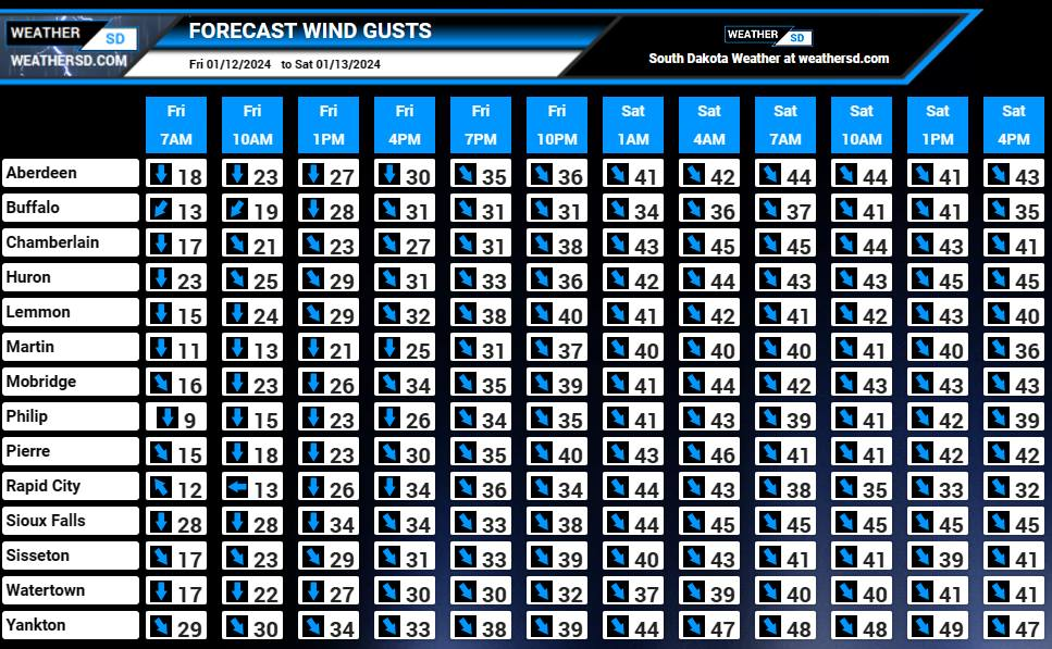
Strong northwest winds will push down the cold air, but will also create ground blizzard conditions or near blizzard conditions for those who have snow on the ground on Saturday. Visibilities are forecast to be reduced to half of a mile or less with wind gusts up to 40 to 50mph for Saturday. The National Weather Service has issued a Blizzard Warning for counties in southeast, South Dakota starting at midnight tonight and continuing through Saturday.

Winter Weather Advisories are to the west and north of the Blizzard Warning for later tonight and continuing into Saturday.


For additional information on your local forecast in South Dakota, check out our Forecast Pages.


