

Growing Concerns on Winter Storm
- WeatherSD

- Nov 7, 2022
- 1 min read
Updated: Nov 7, 2022
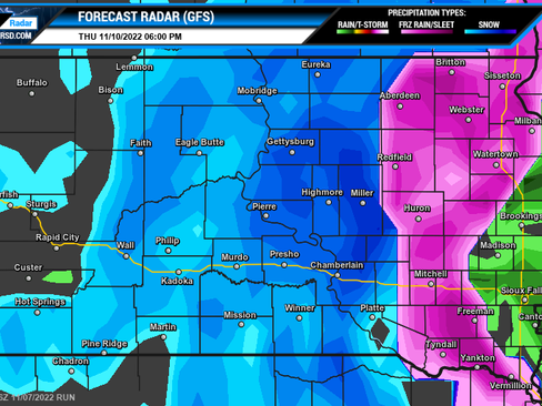
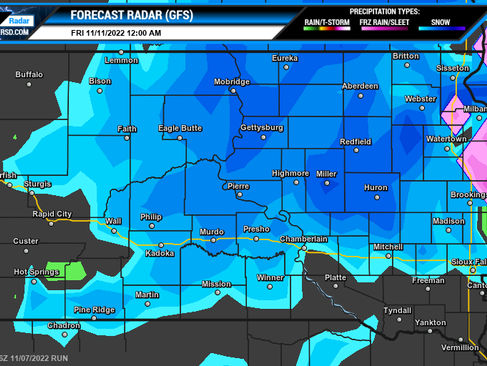
Weather models continued to bring chances for significant snowfall in parts of South Dakota for Thursday and into the first part of Friday. There remains some uncertainty on the exact timing, strength, and track of the storm system which can impact the amount of snow. This morning here is what we are seeing in the weather models.
EURO (ECMWF) Forecast Radar


American (GFS) Forecast Radar


This strong storm system already has the Storm Prediction Center watching parts of northwest Iowa and into Minnesota for the risk of severe thunderstorms on Thursday. We will continue to watch this risk as it easily can shift into South Dakota.
At this time, snowfall amounts look to be significant across the west. Below are a couple of forecast models' outlooks for snow amounts.


Besides heavy snow chances and strong thunderstorms, strong winds will be part of this storm system as well. There is a risk for blizzard conditions with the best chance at this point across northwest and north-central, SD.
Please continue to check back for updates on this storm system and if you want to check the latest weather models maps, visit our weather maps page.


