

Light Snow Potential for the Weekend
- WeatherSD

- Nov 2, 2025
- 1 min read
As we enter November, many of us are aware that winter is approaching. Some of us noticed a few snowflakes on Halloween, and the higher elevations of the Black Hills experienced light snow accumulations in October.

November is typically the month when snow starts to accumulate across the plains in South Dakota, but will that happen this year? The latest forecast models suggest a possibility of light snow accumulations by next weekend into the following week, although not all models are in agreement.
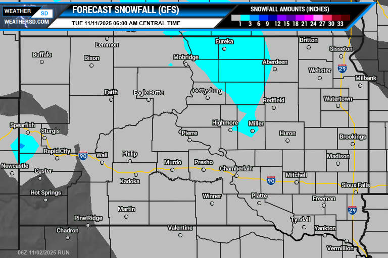
The 06z run of the American GFS model shows that majority of the state may see a dusting or accumulations under one inch for the week with a few locations in north-central South Dakota seeing a little bit more. The model suggests better accumulations over the Black Hills, with some areas expected to receive three inches or more.
The European model during its 00z run is saying, 'hold the phone,' as amounts will be less, with only a dusting across the northeast and east-central regions, and some accumulations across the Black Hills.

Recently, the Canadian model disagrees with moving minor snow accumulations from the state into Minnesota.

Keep checking back, as there is potential for a few places that could see minor amounts of snow within the next ten days. To stay up-to-date with the latest model runs, visit our Weather Maps page.


