

Storm Update: March 30th AM
- WeatherSD

- Mar 30, 2024
- 1 min read
Updated: Mar 31, 2024
WE WANT TO MAKE SURE YOU HAVE THE MOST UPDATED INFORMATION. THIS WEATHER STORY HAS EXPIRED. PLEASE VISIT OUR WEATHER NEWS PAGE FOR THE MOST UPDATED INFORMATION ABOUT THIS STORY, OR VISIT OUR FORECAST PAGES.
The storm system is still on track to impact this holiday weekend, bringing a mixture of precipitation. Winter Weather Advisories are in effect for the Black Hills for today and into tonight, where three to five inches is expected before another hit of snow comes for Easter afternoon and into Monday.

Precipitation will continue to move into southwest South Dakota this morning and continue to spread into central regions of the state by this evening. Some of the precipitation will come as rain as temperatures will be above freezing. Across the Black Hills, the bulk of precipitation will fall as snow.


By Easter, another round of precipitation will move into western, central, and southern regions of the state, with rain across central and southern SD to a mixture of precipitation in the west.


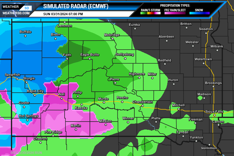
Sunday night, the precipitation will spread into much of eastern South Dakota as well, with snow out in the west. The chance of precipitation continues into Monday.


The two major weather models are keeping the heaviest snows across western, South Dakota where some locations could pick up a total of six to nine inches from now until Tuesday morning.


