

South Dakota Hit Once Again from Winds and Tornadoes
- WeatherSD

- Jul 29, 2025
- 3 min read
Severe weather hit the state again on Monday night. Thunderstorms formed on Monday afternoon, rapidly intensifying and generating a few tornadoes in south-central South Dakota.


A thunderstorms near the Dixon area or northeast of Winner produce a couple of tornadoes. A confirmed tornado was reported along State Highway 44 near the small town of Dixon. There was an unconfirmed report by a storm chaser that the tornado impacted a home in the area.
Up towards the north, another strong thunderstorm became tornado warned by the Fort Thompson area. About six miles east of Lee's Corner, a funnel cloud was reported by a storm chaser. As the storm continued south, a funnel cloud was observed over the town of White Lake. At this time, no confirmed reports of any tornadoes with this storm.

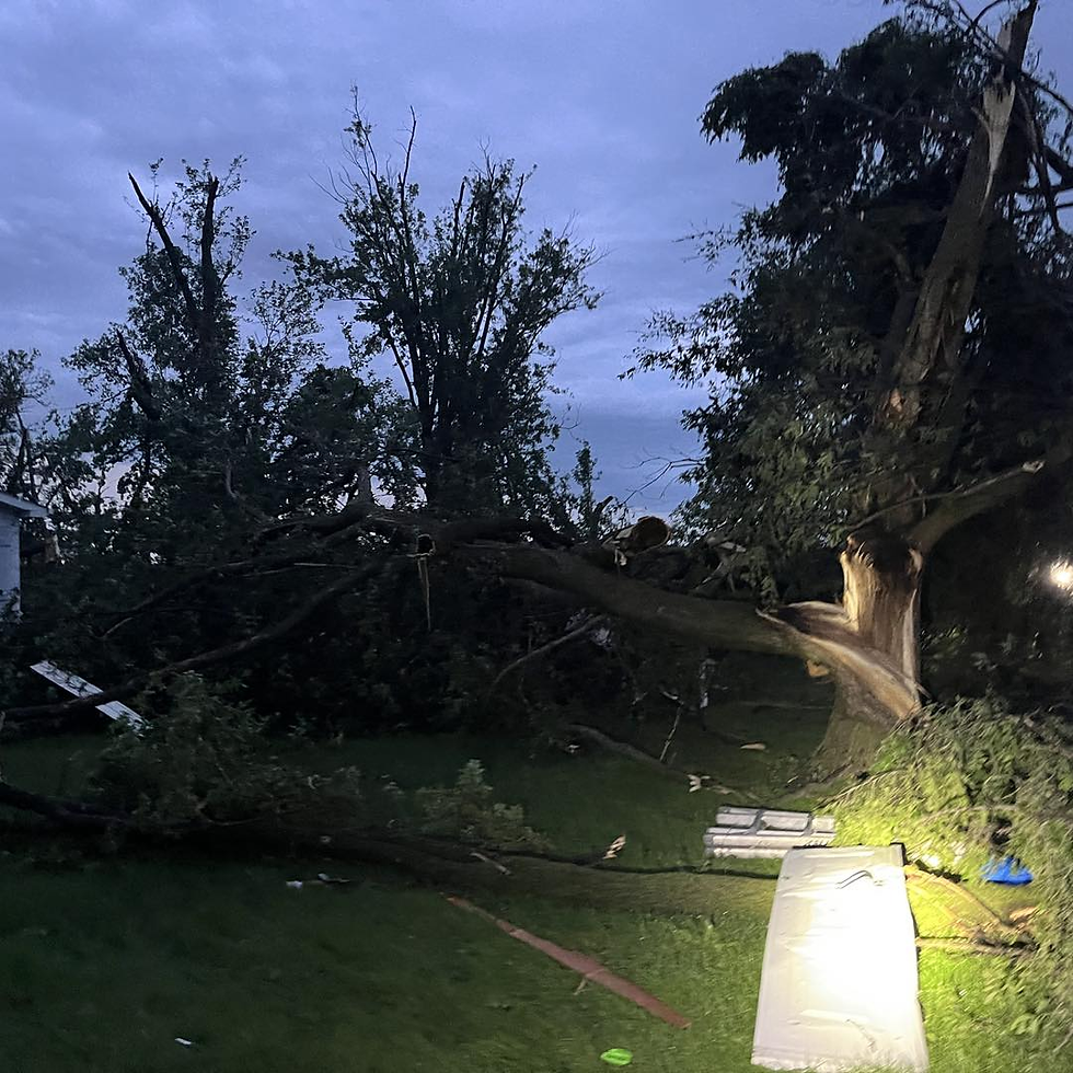
These storms then combine into a line and become a damaging wind threat as they move closer to Sioux Falls and Interstate 29. Damaging winds as high as 87mph pushed eastward across southeast South Dakota and into parts of Iowa. Large trees, power lines, and even a cell phone tower were blown down, along with a couple of buildings that were damaged.


Thunderstorm Wind Gusts:
4 mi E Irene - 87.00mph
3 mi ESE Parker - 85.00mph
1 mi WNW Summit - 77.00mph
6 mi SSE Centerville - 77.00mph
3 mi SSW Beresford - 75.00mph
1 mi NW Wagner - 72.00mph
2 mi WNW Scotland - 72.00mph
1 mi WNW Summit - 68.00mph
1 mi N Tea - 68.00mph
1 mi NNE Harrisburg - 68.00mph
3 mi SSW Beresford - 67.00mph
Irene - 66.00mph
3 mi NNW Sioux Falls - 66.00mph
6 mi NNE Monroe - 64.00mph
3 mi S Scotland - 63.00mph
5 mi W Sioux Falls - 62.00mph
3 mi SW Big Stone City - 60.00mph
6 mi SW Scotland - 60.00mph
7 mi NE Lesterville - 60.00mph
4 mi NE Dante - 60.00mph
4 mi NNE Tea - 60.00mph
15 mi SSE Mission - 56.00mph
1 mi ESE Mitchell - 55.00mph
Thunderstorm Wind Damage Reports:
4 mi W Chelsea - Wind driven hail. Several broken windows of cars and damage to siding of the house.
5 mi W Sioux Falls - Large tree limbs broken down by winds estimated at 65 mph.
2 mi NE Davis - Thunderstorm wind gusts tore the roof off a house and uprooted a large tree. Time estimated from radar.
Beresford - Tree and powerline damage.
Alcester - Tree and powerline damage.
8 mi NNW Ireton - EM reports a tree with a roughly 5 foot diameter knocked down. Tree appears at least partially rotted from photos.
Large Hail Reports:
5 mi NNE Cresbard - 3.50"
5 mi NE Cresbard - 2.75"
2 mi E Chelsea - 2.75"
1 mi S Saint Francis - 1.75"
1 mi S Northville - 1.75"
Burke - 1.75"
2 mi E Chelsea - 1.75"
3 mi WSW Lower Brule - 1.75"
2 mi E Eden - 1.75"
1 mi ENE Stephan - 1.50"
7 mi NW Cresbard - 1.50"
Saint Francis - 1.25"
4 mi S Harrold - 1.25"
5 mi S Hamill - 1.00"
4 mi NW Loyalton - 1.00"
3 mi SW Britton - 1.00"
3 mi S Eden - 1.00"
New Effington - 1.00"
Mellette - 1.00"
Tornado Reports:
Dixon - Confirmed tornado on the ground along Highway 44 near Dixon.
Funnel Cloud Reports:
6 mi E Lees Corner - Storm chaser driving westward on Hwy 34 toward Ft. Thompson, looking southwest, reports rotating wall cloud and funnel cloud.
White Lake - Funnel cloud developing right over White Lake.
The latest storm reports for South Dakota can always be found on our Storm Reports page.
Once the official report from the National Weather Service survey teams on the tornadoes is released, we will post it on the website.


