

What to Expect from the Next Clipper System
- WeatherSD

- Dec 10, 2025
- 2 min read
Another clipper weather system is expected to move into South Dakota, bringing a fresh round of wintry conditions. Residents should prepare for a mix of freezing rain, snow, and fluctuating temperatures that will affect different parts of the state in varying ways.
A clipper system is a fast-moving low-pressure weather system that typically originates in western Canada. These systems bring quick bursts of snow, ice, and cold air as they sweep across the northern United States. The current clipper moving into South Dakota will bring a warm front tonight, which means a mix of precipitation types and temperature swings.
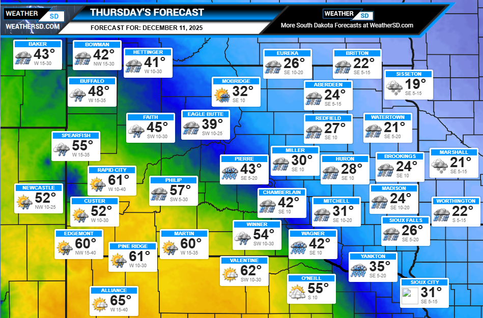
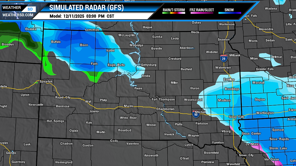
The warm front will arrive in northwest South Dakota tonight, bringing areas of freezing rain mixed with snow. Temperatures will climb into the 50s and 60s during the day, causing precipitation to turn into rain.


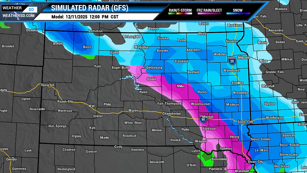
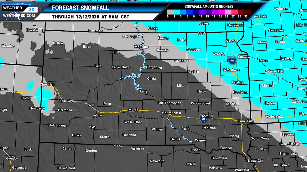
Central and eastern parts of the state will stay colder, with highs only reaching the 20s and 30s. This means precipitation moving eastward on Thursday will fall as freezing rain and snow. Ice accumulations of up to a tenth of an inch are possible, especially from north-central to southeast South Dakota. Snowfall could reach up to two inches, with the northeast seeing the highest amounts.

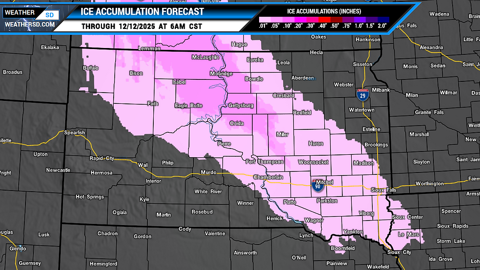
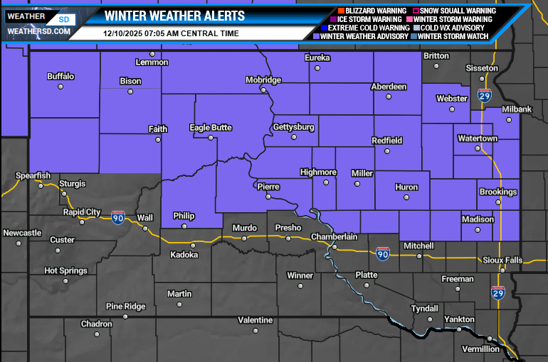
Winter Weather Advisories are in effect for the northern half of South Dakota. The northwest region will see advisories starting tonight, while the northeast will have them beginning Thursday. These advisories warn of hazardous travel conditions due to ice and snow accumulations.
Residents in these areas should monitor local weather updates and plan accordingly.
Safety Tips for Dealing with Freezing Rain and Snow
Drive carefully: Roads may be icy and slippery. Reduce speed and increase following distance.
Prepare your vehicle: Ensure tires have good tread, brakes work well, and windshield wipers are functional.
Keep emergency supplies: Carry blankets, water, snacks, and a flashlight in your car.
Avoid unnecessary travel: If possible, stay off the roads during peak freezing rain or snow.
Protect your home: Clear gutters and check heating systems to prevent ice dams and freezing pipes.
Watch for ice accumulation: Even a tenth of an inch of ice can cause tree limbs and power lines to break.


