Wintry Weather and Winds are Coming
- WeatherSD

- Nov 24, 2025
- 1 min read
A storm system is expected to continue pushing precipitation into South Dakota tonight and into tomorrow. This system has already brought strong winds over 60mph to parts of Montana and, at times, even Snow Squall Warnings.

Looking at the Euro weather model from the 12z run from Monday shows rain, mixing with snow, moving into the region during the overnight hours, mainly impacting the north of Interstate 90. The precipitation continues to spread eastward on Tuesday morning and persists through the day. By Tuesday evening, the precipitation is expected to be out of the west and then by Tuesday night out of the state as it continues into Minnesota.
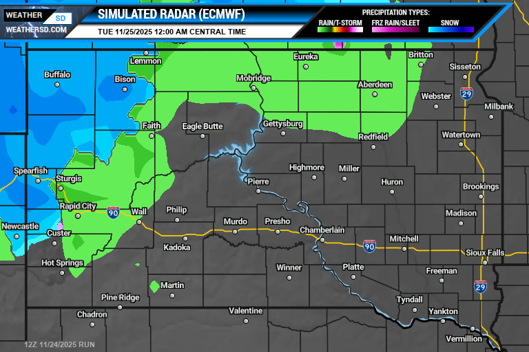


The forecast models agree that the best chance of snow accumulation will be across the northeast, near the Sisseton area, where around 6 inches are possible, with some isolated higher amounts. Lesser amounts of snow are expected as you go south and west from there. Local


The National Weather Service has issued a Winter Weather Advisory for northern counties along and north of US Highway 12, with wintry weather and strong winds that could lead to blowing snow. Also, wind headlines, including High Wind Warnings, are up, with wind gusts from 45 to 60mph expected. The latest South Dakota weather alerts and information can be found on our weather alerts page.