

EF2 Rating for Codington County's Twister
- WeatherSD

- Aug 2, 2025
- 1 min read
From the National Weather Service in Aberdeen's damage survey report. A low pressure system and nearly stationary front was the focus for severe weather on July 27 and 28. Over the two days the region experienced tornadoes, hail, straight-line winds and flooding.
The evening of July 27th, storms formed along the frontal boundary in an environment suitable for tornado development. Around 5:55 pm a tornado touched down northeast of Henry, South Dakota. This tornado would track just west of a farm, but close enough to destroy a house and many other structures on the property.
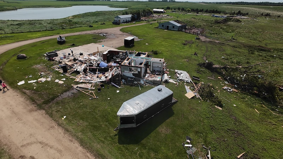
The 21 minute long tornado traveled just shy of 4 miles and a damage survey concluded the tornado was rated a high end EF2 with peak winds near 135 mph. Residents were not home at the time of the tornado. Click on the track in the map below for a complete description. High winds in Watertown, SD were also reported, along with large hail and flooding across Codington and Hamlin Counties. Additional flooding also occurred further north in Big Stone and Traverse counties in west central Minnesota.
Another round of severe weather would develop on July 28th. Individual storms would produce large hail, with the largest stones reported in Faulk County, near Cresbard. Hail up to 3.5 inches in diameter was reported in this area. Strong winds would also be reported in parts of northeast South Dakota. Photos also showed boats and pontoons flipped on Big Stone Lake from straightline winds. Flooding from July 27th was exacerbated with rains on July 28th.


