

High Winds and Freezing Rain Potential
- WeatherSD

- Dec 7, 2025
- 1 min read
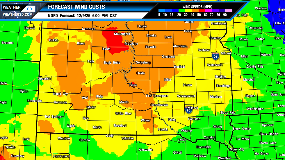
Starting Tuesday and continuing into late Tuesday night, northwest winds will strengthen significantly over South Dakota, with gusts reaching between 40 and 65 mph. The strongest winds are expected over the western and central regions of South Dakota, prompting a High Wind Watch for the area.


Alongside these gusty conditions, early Tuesday morning may bring freezing rain in the north-central and eastern parts of the state ahead of the temperatures rising above freezing. While the exact boundary between rain and freezing rain remains uncertain, all three major forecast models are mainly focusing on the north-central and northeast regions for the potential for ice accumulation.


By staying informed, you can adjust your plans and keep yourself and your family safe. Check our South Dakota local weather pages for local forecasts and hour-by-hour weather.


