

Watches Go Up for Storm
- WeatherSD

- Nov 7, 2022
- 1 min read
As we move closer to the impacts of a possible winter storm, the National Weather Service has placed a number of counties in northern and western, South Dakota under a Winter Storm Watch.
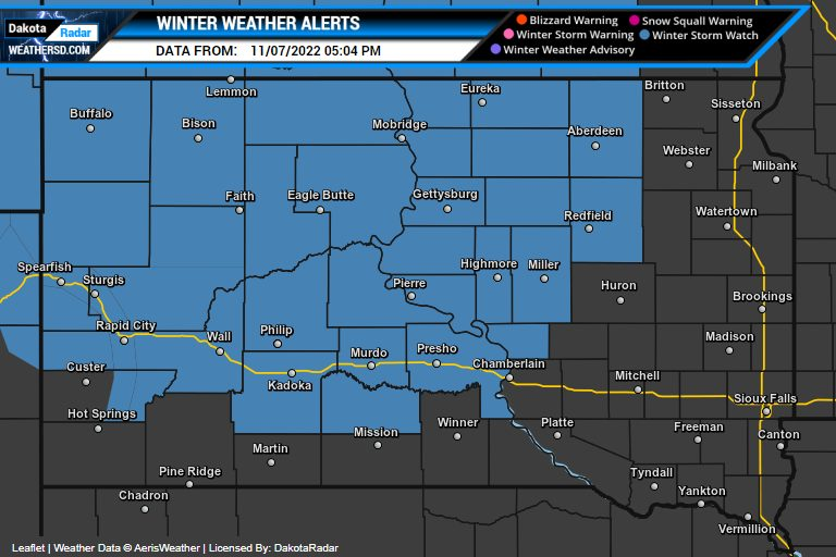
The forecast models this afternoon have shifted the heaviest snowfall amounts into parts of north-central, South Dakota, and up towards North Dakota but several inches of snow remains on the table for counties across the north and back into west-central, South Dakota.


The major impacts from the storm system look to start on Wednesday evening as rain and thunderstorms across the east.


During the overnight hours on Wednesday night, precipitation is expected to become more widespread with snow in the west, a mixture of freezing rain for central, SD, and main rain for the east.

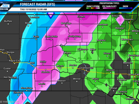


The precipitation in the east will change to snow by late Thursday and come to an end by Thursday night.


Besides precipitation, very strong winds and areas of blowing snow, and possibly blizzard conditions are also expected.
Please keep checking back with DakotaRadar as we will post an update tomorrow morning.


